 |
||||||||||||||||||||||||||||||||||||
 |
|
|||||||||||||||||||||||||||||||||||
Copyright 2010 LandChoices - All Rights Reserved |
LandChoices Press Kit
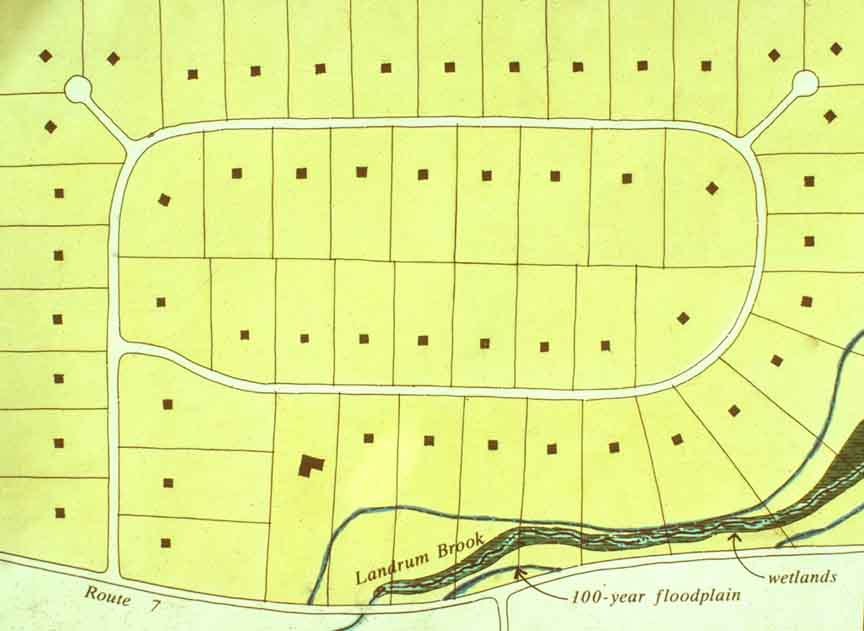
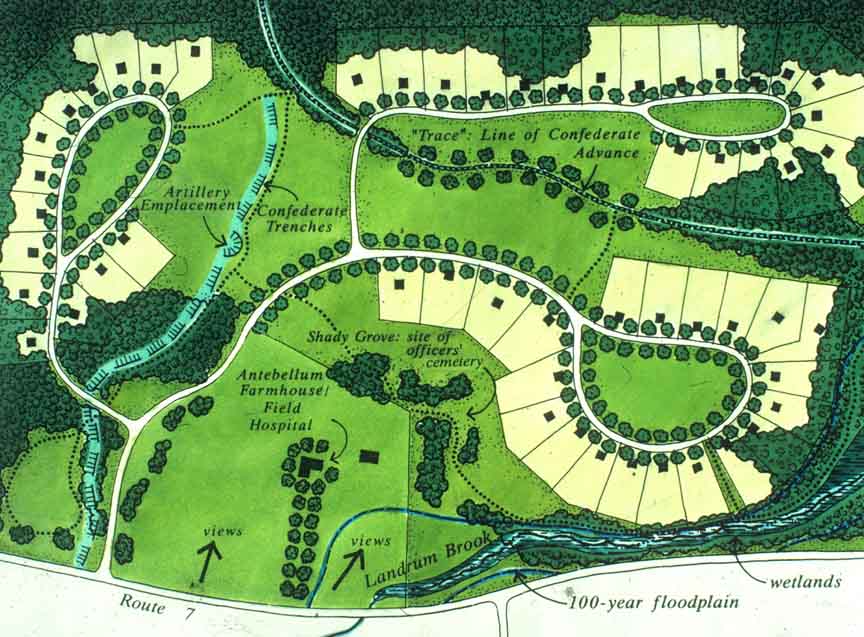
Farm with Cival War Battle-Related Resources Conventional subdivision (below left) with two acre house lots vs. a conservation subdivision (below right) with just under 3/4 of an acre, 30,000 sq. ft., house lots a 130 acre historic site. The conservation subdivision preserves almost two-thirds of the site, 62%, 81 acres, while allowing the SAME number of home sites (55).
Another Example Conventional development vs. conservation subdivision below.
|
|||||||||||||||||||||||||||||||||||
|
|
||||||||||||||||||||||||||||||||||||


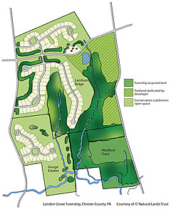
| Conservation Developments Preserve Interconnected Networks of Protected Natural Areas Conservation subdivisions provide an interconnected network of protected natural areas to protect wildlife, water quality in lakes and rivers, and working farmland. In London Grove Township, Chester County (PA), 138 acres, over 65% of the 211 total acres that could have been developed, have been preserved in the two conservation subdivisions. A public trail connects the neighborhoods and parkland. Conventional "cookie cutter" subdivision design would have filled the parcel with house lots and streets. The site plan shows three parcels along tributaries to the White Clay Creek, designated under the federal Wild & Scenic Rivers program. The Township acquired the darkest green parcel with County grant funds and a conservation subdivision developer donated the hatched parcel, at no cost to the Township. Two Homeowners' Associations own and maintain the conservation subdivision open space. |
London Grove Township LondonGrove.pdf (3.7MB) 1935X 2367 pixels (JPEG 882k)
|
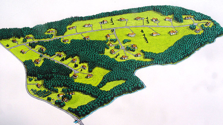
| Lamborn, the very large conservation subdivision on both sides of the road is 149 acres, with 105 lots and 103 acres of preserved open space. Of the 103 acres of open space, the developer donated 44 acres, at no cost to the Township, as a park. Gouge, the small subdivision with the circles, is 62 acres, with 35 acres of open space. Medford, at 35 acres, is a Township park. Not labeled is a 6 acre sliver the township bought in between the two to join them. This is a wonderful example of a township planning ahead to preserve natural lands while allowing growth. -- Please Credit: Natural Lands Trust |
|
|
River Valley with Woodlands and Meadows
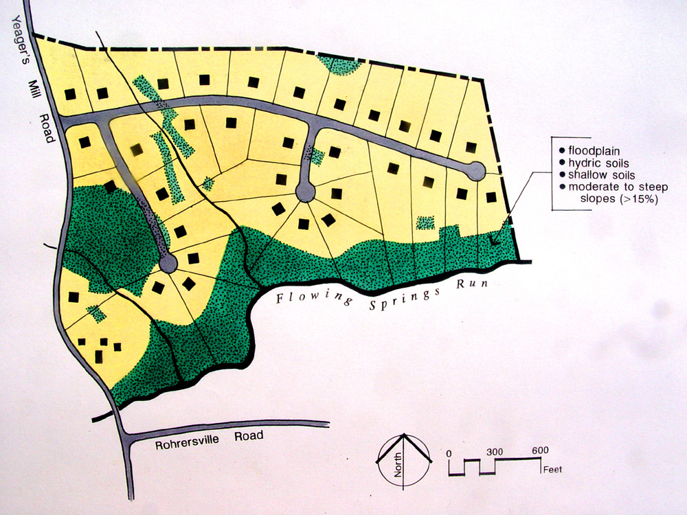
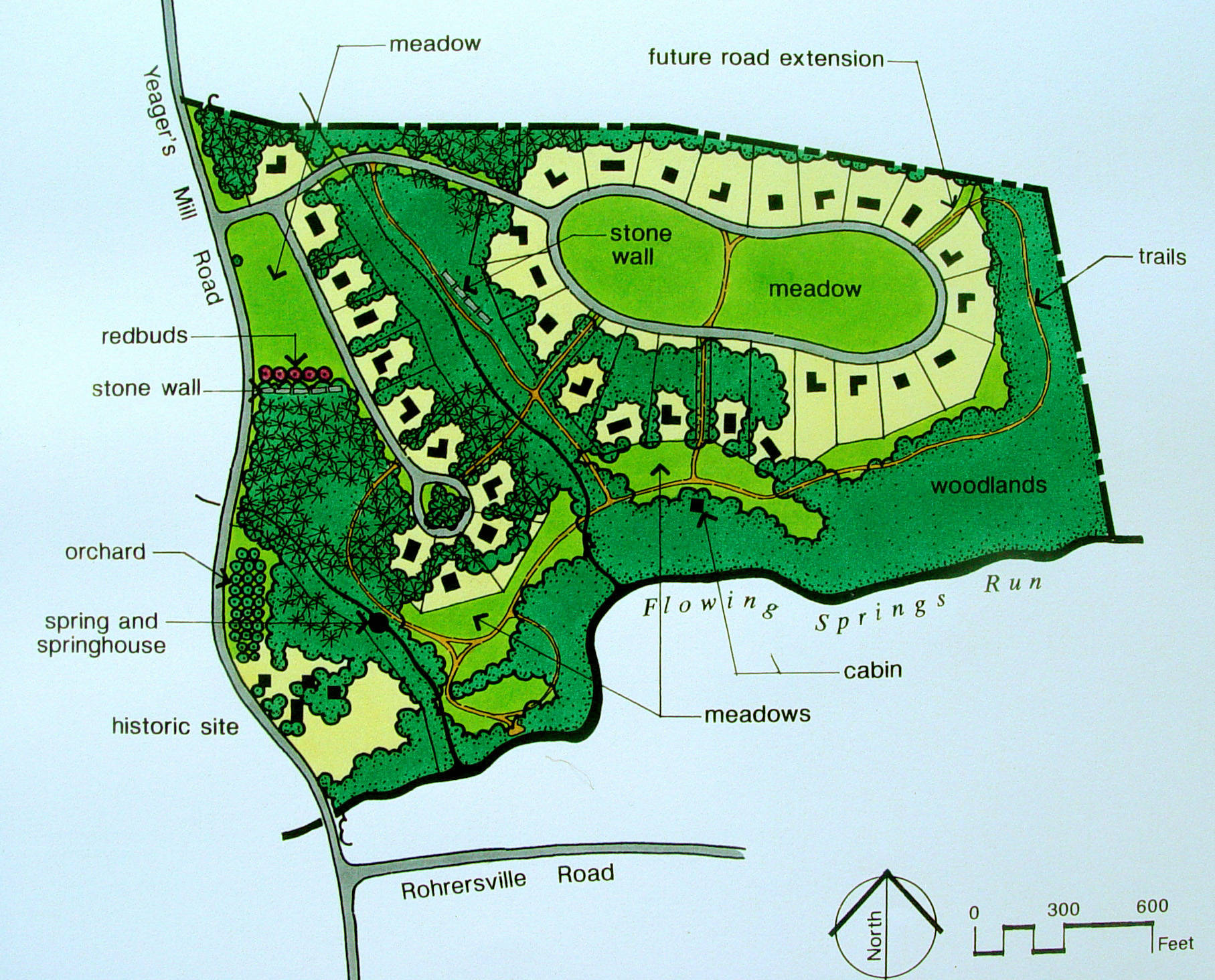
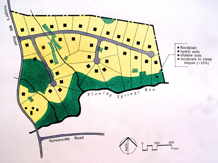
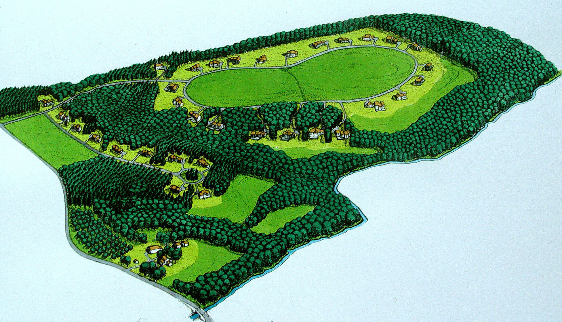
This 85 acre site of mixed woodlands, fields, and meadows is located along a tributary of a very large river. This upland site includes large areas of mature hardwoods and smaller areas of young hemlock forests, together with a number of meadows and hayfields, bordering a headwaters stream that has been designated as having exceptional water quality. "Under ordinary circumstances, the entire property would almost certainly be developed into a checkerboard pattern of 'wall-to-wall' houselots," says author and land planner Randall Arendt. The original zoning (below left) called for 34 house lots, minimum 80,000 square feet (just under two acre house lots). In the conservation subdivision design (below right), just over 36.3 acres of the site is taken up by houselots (34) and streets, the average lot size being 36,000 square feet, or 0.85 acres (just under one acre house lots). 48.5 acres, almost two-thirds of the site, are undivided and permanently protected open space. For all River Valley images, please credit: Randall Arendt, Growing Greener: Putting Conservation into Local Plans and Codes, Island Press, 1999 |
|
 |
 |
| River Valley Lot Yield Conventional Subdivision Suggested caption: The original site plan called for a conventional subdivision of 34 house lots of 80,000 square feet (just under two acres) each on the 85 acre site, taking up all but the unbuildable land. 1000 X 750 pixels (290k) 700 X 525 pixels (107k) |
River Valley Lot Lines Conservation Subdivision Suggested caption: In the conservation subdivision, 34 houselots average 36,000 square feet (0.85 acres, just under one acre) each, on the 85 acre site, preserving 48.5 acres, almost two-thirds of the site, as permanently protected open space. 1815 X 1464 pixels (527k) 700 X 565 pixels (107k) |
 |
|
| River Valley Conventional Site Plan 2048 X 1152 pixels (597k) 750 X 422 pixels (115k) |
River Valley Conservation Subdivision Site Plan 1853 X 1119 pixels (762k) 750 X 430 pixels (127k) |
|
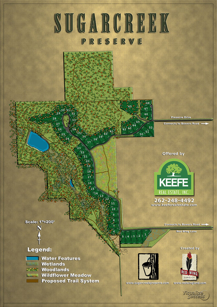
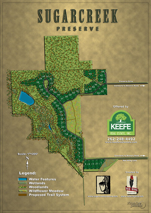
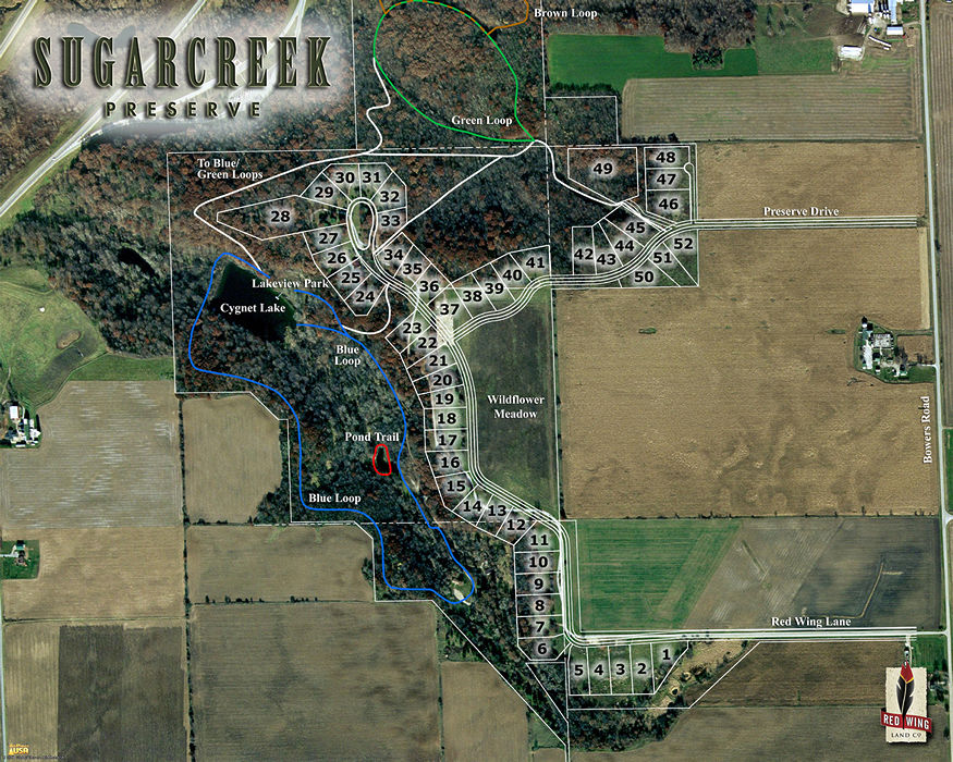
Sugar Creek Preserve (Wisconsin)
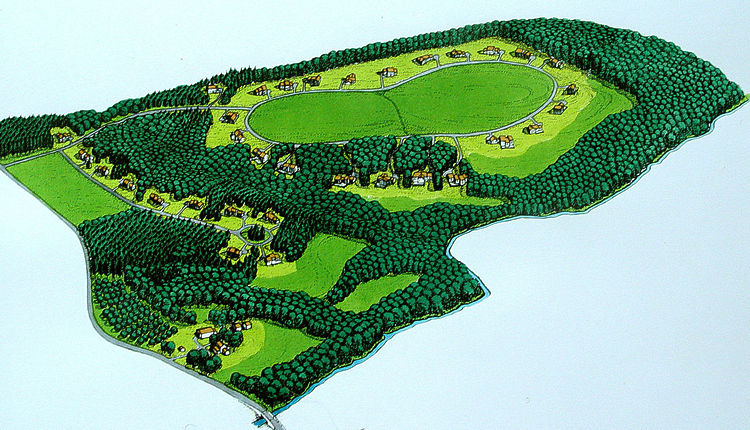
Sugar Creek Preserve is a conservation subdivision with 52 homesites on 260 pristine acres in Walworth County's Sugar Creek Valley. Originally zoned for 52, 5 acre house lots, the property was destined under conventional zoning to become filled with houses, lawns and streets as most trees would have been cleared, rolling hills graded flat and the lake, pond and stream shores filled with homes. Using conservation subdivision design, approximately 177-acres, over 69% of the site, is permanently preserved as open space, including a lake, pond and stream, while still allowing 52 home sites. Sugar Creek Preserve creates a haven for homeowners, while protecting the extraordinary woodlands, fields, pond and sparkling stream. Lots range from 40,510 sq. ft. (.93 acres) to 187,448 SF (4.3 acres) with the average being 53,500 sq. ft. (1.3 acres). The proposed density yields 1 home site for every 5 acres of land. The site meets the conservation subdivision ordinance requirements in Walworth County, Wisconsin, where LandChoices' Approved Conservation Subdivision Ordinance originated. |
|
 |
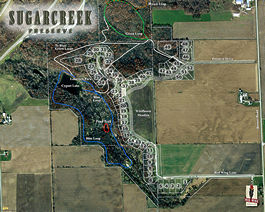 |
| Sugar Creek Site Map (WI) (Please credit Red Wing Land Company for image) Suggested caption: Sugar Creek Preserve is a conservation subdivision in Walworth County, WI with 177-acres, over 69% of the site, permanently preserved as open space. 1061 X 1500 pixels (548k) 707 X 1000 pixels (219k) 495 X 700 pixels (110k) |
Sugar Creek Aerial Map w/ Trails (WI) Please credit Red Wing Land Company 2125 X 1700 pixels (974k) 1375 X 1100 pixels (469k) 875 X 700 pixels (220k) |
 |
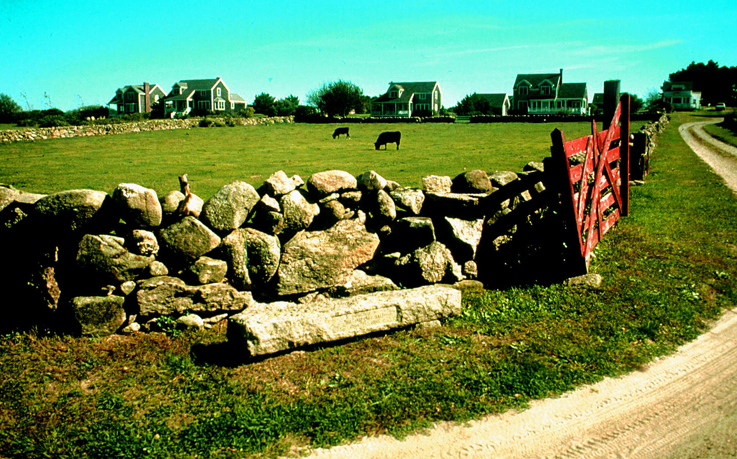
Trim's Ridge (Rhode Island) The original farm stone wall and part of the farm pasture have been preserved at Trim's Ridge, This ten-acre conservation design subdivision, located in New Harbor, New Shoreham, RI, protects 3/4 of the site as open space. The original zoning designated an unimaginative layout of ten one-acre lots, five on each side of a cul-de-sac, which would have destroyed the stone walls, pastures and natural areas. Thankfully, the developers were able to persuade local officials and neighbors to allow conservation subdivision design. Trim's Ridge (RI) Photo Credit: Randall Arendt Trim's Ridge: 1448 X 902 pixels (479k) Trim's Ridge: 850 X 529 pixels (198k) |
 |
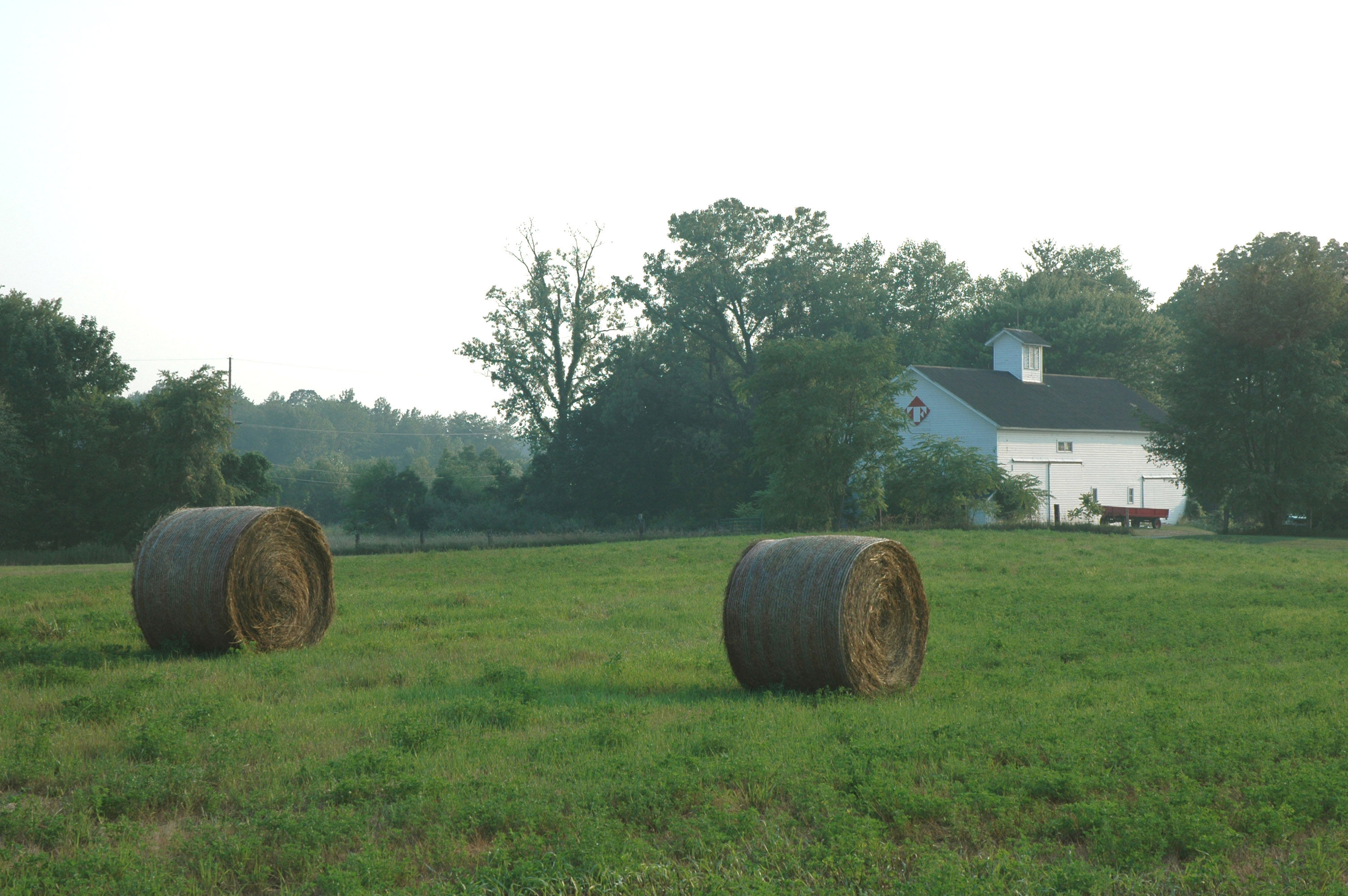
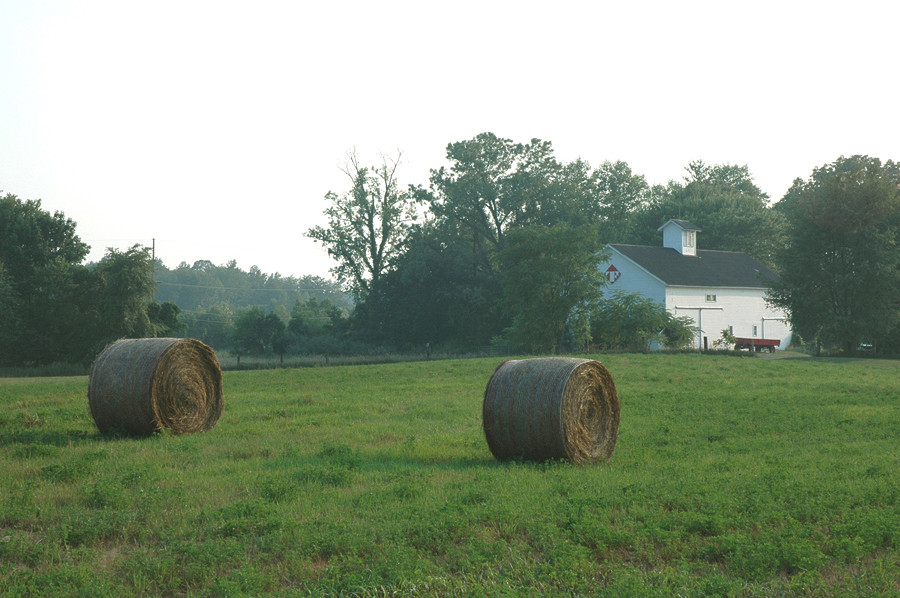
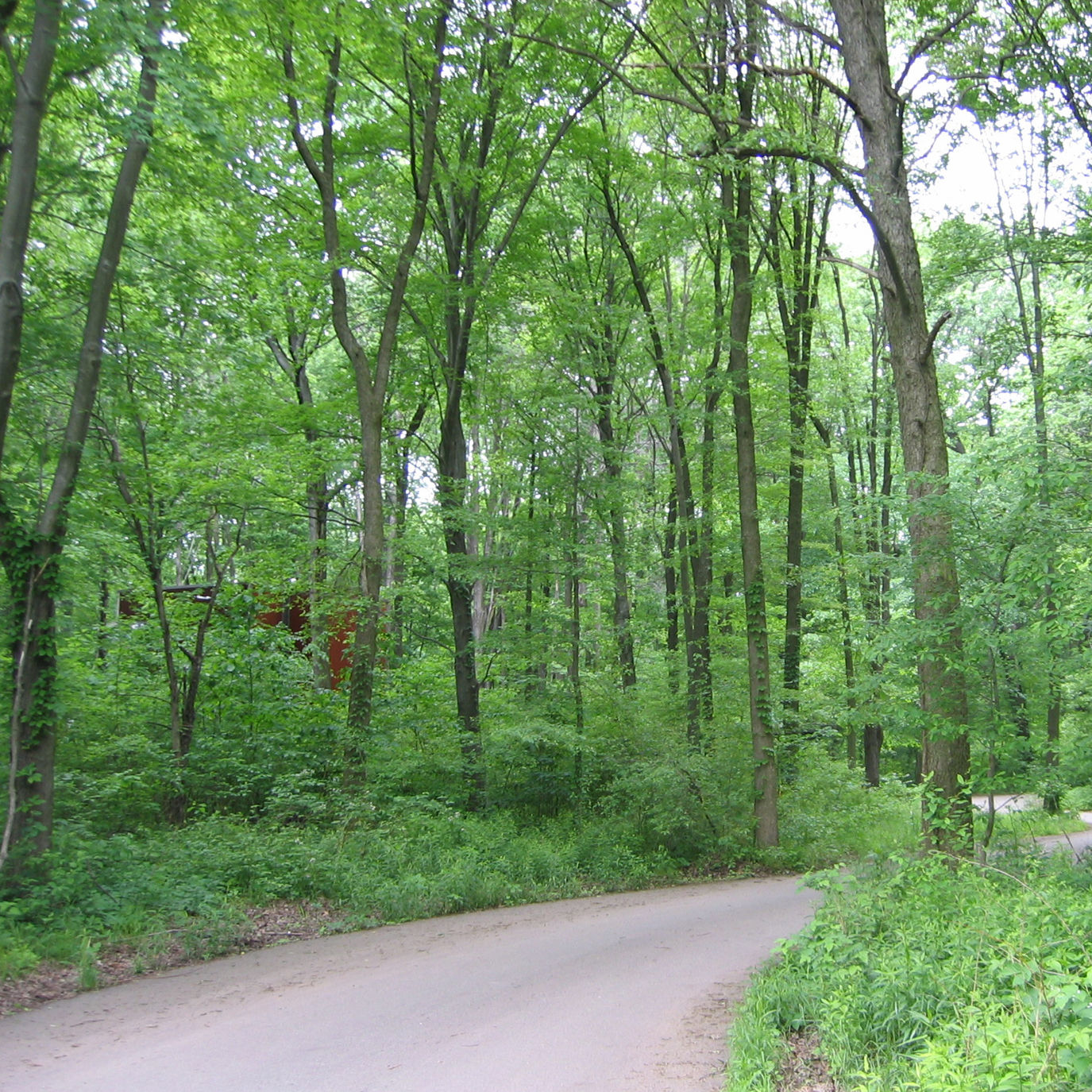
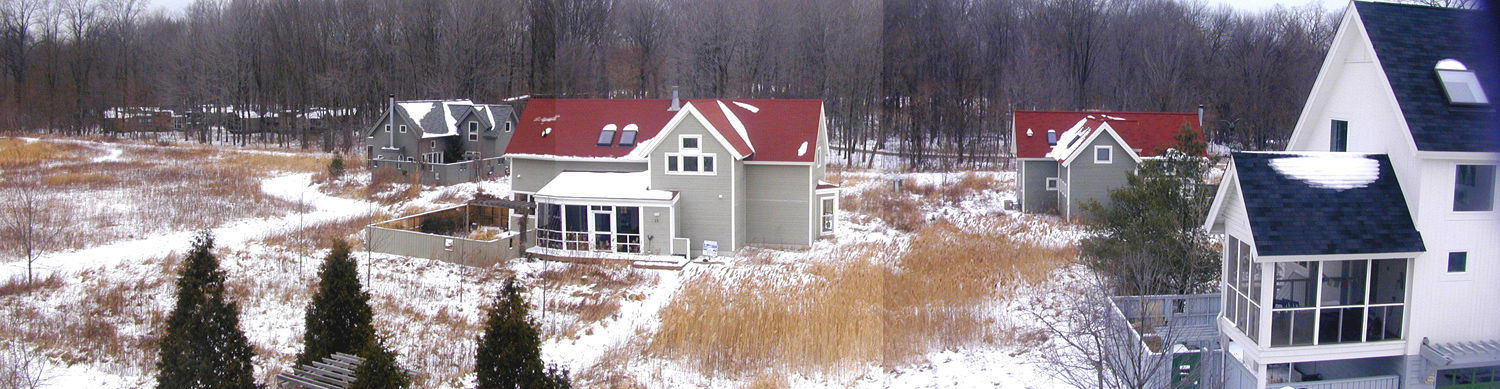
Tryon Farm (Indiana) This is your view on the drive out from Tryon Farm, a conservation subdivision in northwest Indiana. This 40 acre field is farmed and permanently preserved. The preserved barn is enjoyed by the residents. Four goats live in the barn also. The red wagon next to the barn is used for hayrides and provides countless hours of fun for residents. Tryon Farm Barn: 3008 X 2008 pixels (905k) 900 X 598 pixels (165k) |
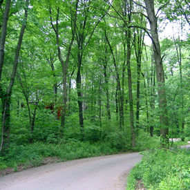 |
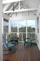
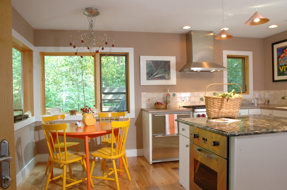
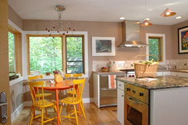 Right View out kitchen windows of Tryon Farm (Indiana) Right View out kitchen windows of Tryon Farm (Indiana)Tryon Farm Kitchen: 2000 X 1330 pixels (395k) 1000 X 665 pixels (151k) Left One of the roads through Tryon Farm, a conservation subdivision in northwest Indiana. |
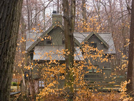 |
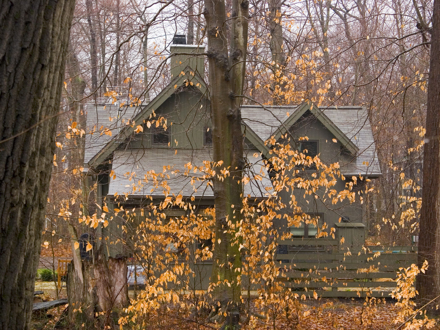
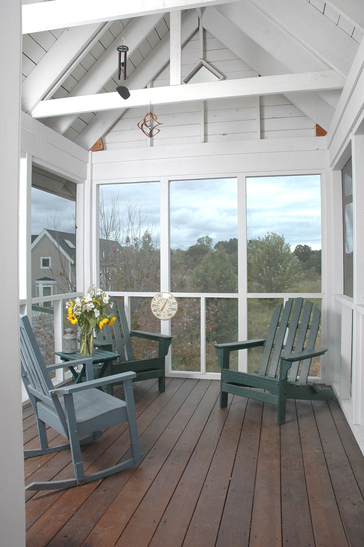
 Left Home nestled in the woods at Tryon Farm (Indiana) Left Home nestled in the woods at Tryon Farm (Indiana)Tryon Farm Woods: 1532 X 1149 pixels (618k) 850 X 638 pixels (211k) Right View of protected natural lands from homeowner's porch at Tryon Farm (Indiana) Below Homes at Tryon Farm (Indiana) are surrounded by permanently protected fields and forests interlaced with hiking trails. |
 |
|
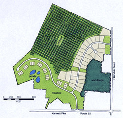 |
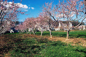
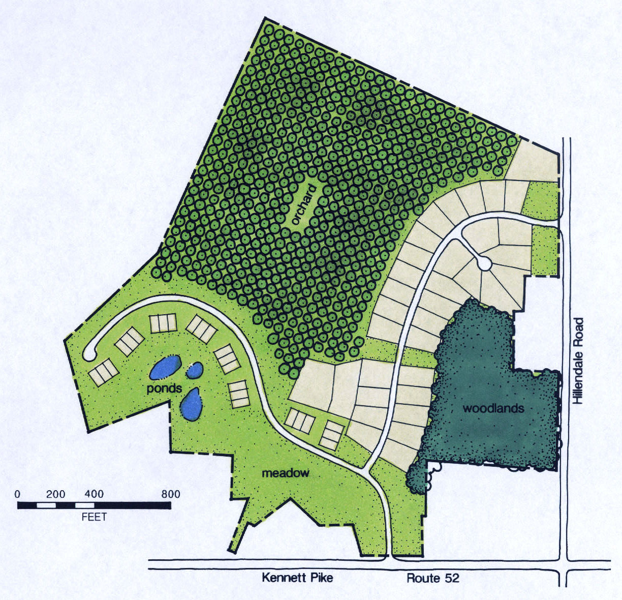
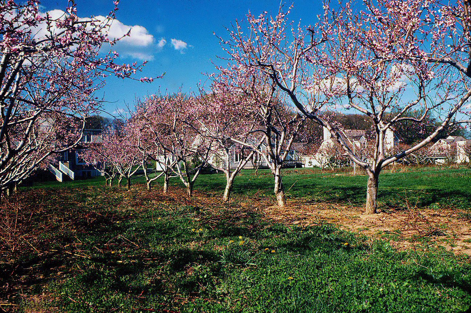
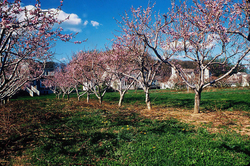
The Ponds At Woodward (Pennslvania) Landowners turned down a developer's proposal that would have destroyed the 50-acre orchard on this 120 acre property. Developer's received a 62% greater return by preserving the orchard in a conservation design subdivision with 57 homes. As a result, two-thirds of the property has been permanently protected, including ten acres of mature woodlands and a working orchard (producing apples and peaches) encompassing more than 50 acres. Moreover, the family's economic return was substantially increased over that which a conventional alternative would have generated. The Ponds At Woodward Site Map Please credit Randall Arendt 1224 X 1180 pixels (434k) |
 |
The Ponds At Woodward Please credit Randall Arendt 1518 X 1008 pixels (1.3MB) 850 X 564 pixels (333k) |
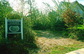
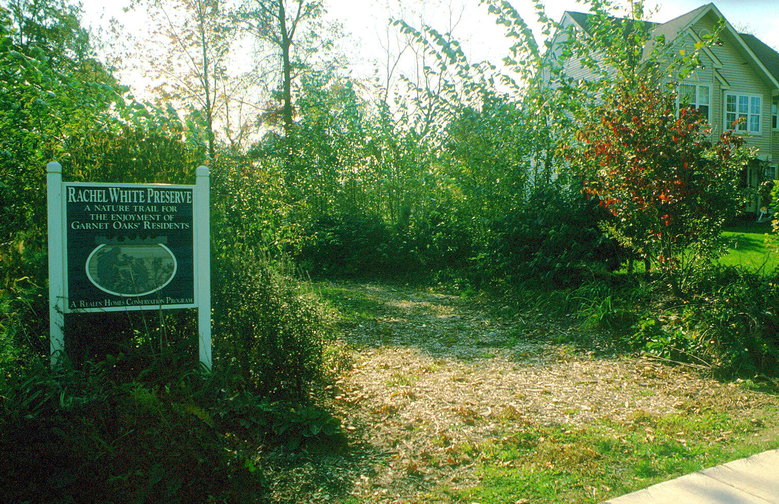
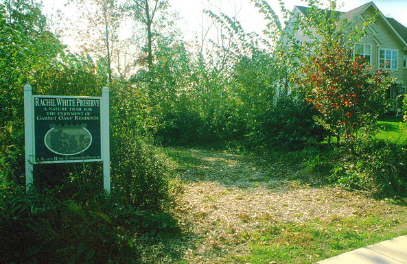
| Garnet Oaks (Pennsylvania) A large wooded area named the Rachel White Preserve (in photo) honors the farm estate that once occupied the site. Located in Bethel Township, PA, Garnet Oaks contains 80 homes on 58 acres and preserves 51% of the land as open space. Structures from the original estate are preserved including a stone wall. The original site — hilly and heavily wooded — featured trees at least 40 years old. The conservation design allowed the developer to preserve many of them. An extensive trail system meanders through the preserved natural areas and is constantly enjoyed by residents. According to the National Association of Homebuilders, sales were brisk and prices rose significantly during build out of the development. A detailed nature trail and historic guide is available for homeowners at Garnet Oaks. A local Boy Scout Troop built the trail system. Garnet Oaks (PA) Please credit Randall Arendt Garnet Oaks Trail: 1520 X 984 pixels (741k) Garnet Oaks Trail: 593 X 385 pixels (121k) |
 |
| Preserve Your Land | Conservation Subdivisions | Other Choices Home | About Us | News | Projects | Sponsors | Contribute | Contact Us | Links | Kids | Media Kit LandChoices • P.O. Box 181 • Milford, MI 48381 • 248-685-0483 • info@landchoices.org Privacy Statement | www.landchoices.org |
||||
Copyright 2007, LandChoices - All Rights Reserved